Achitecture - Photogrammetry
DCM uses Photogrammetry to process measurements from pictures. This scientific and accurate measurement method provides a number of benefits to organizations involved with Architecture.
There are two types of Photogrammetry classifications. DCM uses the first classification called Close-range Photogrammetry. Close-range Photogrammetry uses non-specific, everyday cameras to create drawings and 3D models of items, locations or buildings. Historical pictures can be used to provide great detail and modelling opportunities.
The other classification is Aerial Photogrammetry which typically focuses on topographic products such as terrain or topographic maps. DCM is capable of processing aerial photographs, but requires the photos to be submitted.
DCM is capable of determining measurements using Photogrammetry via two processes. The first includes processing from pictures to provide scientific conclusions of measurements of the item in question. These pictures can be historic in nature and age or of recent development.
The second process involves DCM attending a scene or location and take pictures as a component of the service for analysis immediately or at a later date. DCM offers an on-demand service whereby pictures are taken of the item in question and stored in a secure database until such time that measurement analysis is required (such as after a fire or development of virtual promotion).
Organizations can use DCM Photogrammetry services to:
- Rebuild or repair heritage or current structures based on measurements determined from pictures.
- Archive images for on-demand processing when required
- Development of promotional and/or educational representations
- DCM can take pictures of buildings “as-is” and provide detailed measurements from those pictures.
- Review impact of development around existing buildings or structures
- Complete measurements on sensitive architecture without disturbing the integrity or structure.
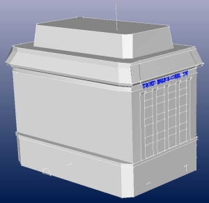
- Capable of recreating complex detail
- Lifelike 3D models