Archaeology - Photogrammetry
DCM uses the process of solving measurements from pictures to create accurate 3D, textured models of artefacts. This process of measuring and modelling historic sites, monuments, statues, etc... is completed in a manner that does not disturb the item under review. Photographs provide all the information necessary to complete the measurement analysis. This provides an opportunity to measure sensitive areas without affecting the integrity or stability of the item(s).
In addition, DCM can provide measurements of complex structural components through the use of Photogrammetry.
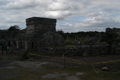
DCM primarily uses the first of two classifications of Photogrammetry called Close-range Photogrammetry. Close-range Photogrammetry uses non-specific, everyday cameras to create drawings and 3D models of artefacts and items of historical significance. One of the strongest benefits of using Photogrammetry to solve measurement problems with artifacts is that historical pictures can be used to provide great detail and modelling opportunities for items long since lost or destroyed.
The other classification of Photogrammetry used by DCM is called Aerial Photogrammetry which typically focuses on topographic products such as terrain or topographic maps. If you do not already have images for this purpose we can arrange proper flight parameters to ensure proper coverage and accurate results.
DCM can use pictures submitted by organizations, but can also attend sites or locations to take the pictures personally.